14 July 2019
The beauty of Rio de Janeiro lays not only in its beaches and holiday atmosphere. One of the cool things for me there is that within the city I can find plenty of opportunities to walk, activities on the open air and nature trails. The location of the city and it's topography favour preserving green spaces as uniquely shaped mountains and hills that are one of the icons of Rio are not suitable for settlement.
The reare several parks within the city boundaries - so it's your choice what area you want to hike. The closest one is just a bus or two ride and only half or one hour away from the busy centre or South Zone to any of the trails' starting points. It also cost you just a bus ticket. No extreme expenses and no time wasting for long commuting out of the city.
Here I am listing the ones that I liked the most and that are worth exploring. You can also watch my aerial video about natural attractions of Rio. Don't forget to subscribe to my channel on youtube!
6. Telegraph Rock and Trail
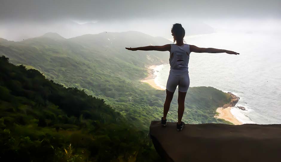
The Telegraph Rock is named after the radio station which was located there during the World War II. It was a military outpost meant to listen and detect German submarines. The peak is famous for a rock which juts so that it looks like you stand on a dangerous place with juts out with a precipice below but actually there is another rock below it and not dangerous at all. For this reason it's a popular photo spot. Many people do the Telegraph Rock hike to take cool picture and admire the views from atop.
The most convenient starting point for the hike is the town of Barra de Guaratiba, which you can reach by bus from Riode Janeiro centre. The town is actually part of the city as well but to get there you need at least 1 to 3 hours - depending where you staying in Rio.
Take the metro to Jardim Oceanico (last tube station) then change for BRT bus. Get off after around 50 minutes at Ilha de Guaratiba stop and change for the bus 897. This last journey takes only 15 minutes and drops you off in Barra de Guaratiba.
From the centre ask locals as you first need to hike in between houses by a very steep street and shortly after get on the trail which leads you straight to the top. The walk takes less than 1 hour, min though it is very steep at the beginning only slightly getting easier later.
Before the summit you pass through the Telegraph Viewpoint which has great view over the Barra de Guaratiba, the bay and a long narrow peninsula called Restinga da Maramaiba. The peninsula is still a military territory with prohibited access to civilians.
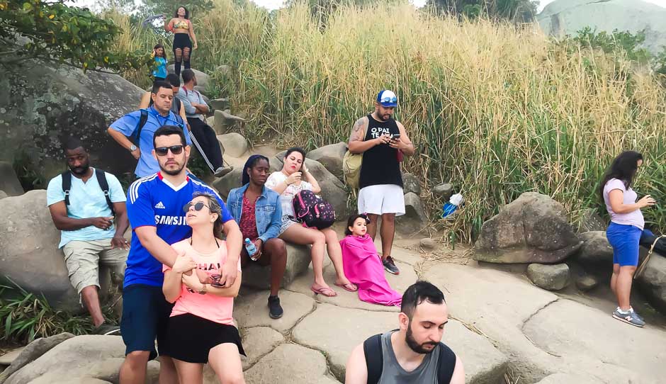
Shortly after the viewpoint you reach the Telegraph Rock itself. Bear in mind that in good days and especially during the weekend there can be a massive queue for the rock to take a photo so prepare for at least 0.5h wait. Even during a week and on rainly day there are peaople there and you can wait at least 15 minutes or more.
The view freom the top is for the other side of the mountain than from the viewpoint and on a sunny day you can see Rio de Janeiro skyscrapers of the the South Zone.
5. Urca Rock
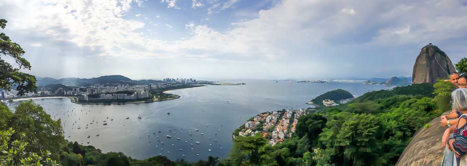
Morro da Urca (Urca Rock) is smaller brother of the famous Sugarloaf Mountain (Pao de Acucar) jutsing out of the south shore of Rio de Janeiro city just at the entrance to the Guanabara Bay. And it's the first stop on the way to the Sugarloaf.
The cable car takes you to the both or you can hike the trail to the Urca Rock instead - to save money or just for fun. It's not difficult and lasts barely half an hour. Just follow the road from the trail start straight to the top. You pass lush forest and can see small hairy monkeys called here mika.
The view from the top is impressive - on to the Sugarloaf itself and to the bay and Rio de Janeiro south and central zones plus Niteroi at the other side of the water. Below is the neighbourhood of Urca with a small exclusive and quiet beach guarded by two military outposts.
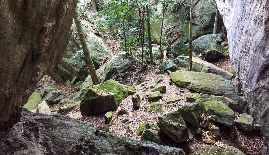
4. Caves Trail
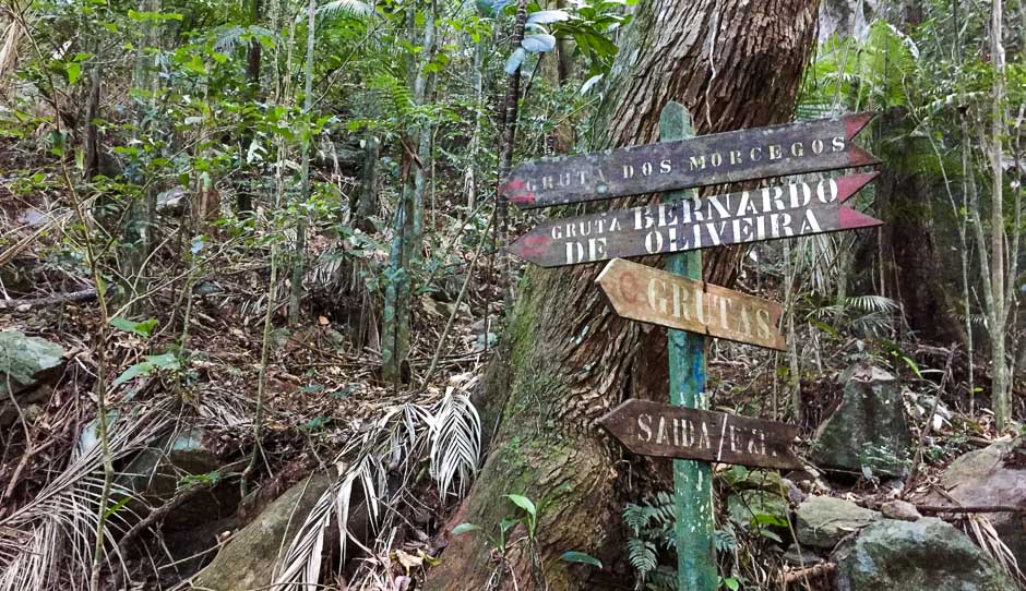
It is less know but surprisingly interesting and picturesque hike again located in the Tijuca National Park. As the name suggests - you can see several caves along the trail, some just caverns or grottos, other ones quite impressive.
To get there take the bus number 301 or 302 from the city and get off at Praca Afonso Viseu right in between two sections of the park. Get through the main entrance and follow the road for a few minutes, and then turn to the trail following the sign "Grutas". After 15 minutes you will reach the La Floresta restaurant (closed) and Midosi Ruins (Ruinas do Midosi). Take the trail that goes left of the ruins and is marked as "Grutas". Another 25 minutes will take you to the Belmiro Cave (Gruta do Belmiro), then Archer's Cave (Gruta do Archer) is just 5 minutes away. After another 25 minutes you reach Gruta B. Oliveira (Oliveira Cave) and Gruta dos Morcegos. The last two are Gruta Gabriela - very small and with concrete bench and table built in and Gruta Paulo e Virginia.
The most impressive to me are the Archer's Cave (pictured above) and the Morcegos Cave. The latter looks like just a hole in the rock but when you get through the narrow entrance you will be surprised to see a large and high room almost completely dark with a flat ground though so it's easy to walk.
This is not the end of the trail though - as you continue you will reach Humaita Ruins (Ruinas da Humaita) and a house located deep in the forest (A Fazenda). However from the house you need to return to get back on to the trail and ultimately reach Os Esquilos - pictoresque and quite expensive restaurant made in a converted country house. From there the trail leads straight back to Mayrink Chapel and the main entrance of the park.
3. Two Brothers Peak
2. Tijuca Peak
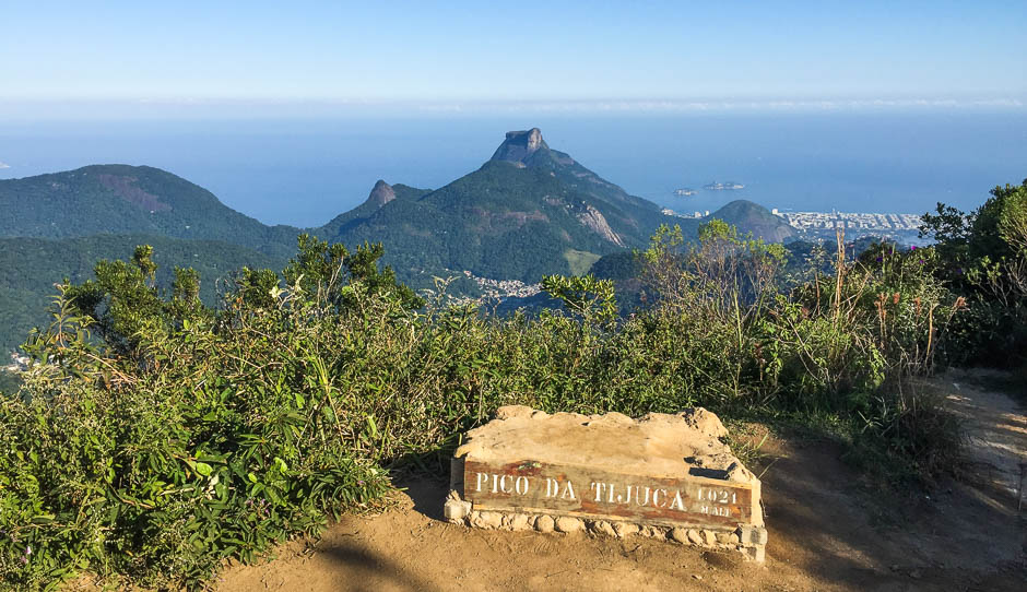
The moutain is the highest in the Tijuca National Park, the forest located right in the heart of the city. It what's left of the ancient rainforest once covering the entire coast, later cut own for settlements and sugar and coffee plantations. The park is split in to a few parts and the peak is located in the central of all of them.
The trail starts at the same location as the Cave Trail - at Praca Afonso Viseu - see above how to get there.
Go to the park entrance and from there follow the signs to the Tijuca Peak (Pico da Tijuca). The hike starts along a road and then turns in to the forest so wear proper walking shoes. The trail is not difficult and it takes around 2.5h one way in a very relaxed walk with plenty of stops for photos and rest. You can easily make it faster if you prefer.
On the way you pass several other attractions of the park for example: Lago das Fadas, La Floresta Restaurant (closed). Then you get to the point where the trail splits - left goes to Bico do papagaio and the right goes to the Tijuca Peak (Pico da Tijuca). Take the right one and later again it splits to the route for Tijuca Mirim and the peak itself that goes right. They are not far away one from each other and you can easily do both of them in one hike. We went first to the Tijuca Peka and on the way back to Tijuca Mirim.
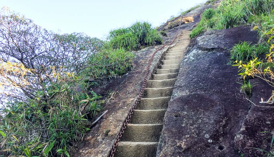
The last part is steep with steps hewn in the rock. There is a chain along it though for support. The views start already there and continue till the summit which is around 10 minutes away from the bottom of the steps.
The view from the top is magnificent - on to the South Zone and the coast and the highest peak of Rio de Janeiro - Pedra da Gavea. From the below the steps you can also see the centre of the city, the north zone with the Maracana Stadium, the other part of the Tijuca Nationak Park where the Christ the Redeemer stands and even thw Governor Island and Niteroi city at the other side of the Guanabara Bay.
1. "Wild Beaches" of Guaratiba
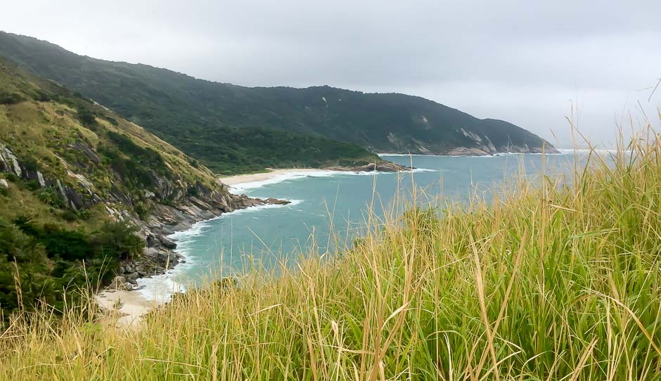
This may sound like yet another beach relaxing experience but... there is a reason why they are called "wild" beaches (praias selvagems). They are located far from houses and are not easily accesible. Because of it there are no bars, chairs to rent or simply crowds of people. The only human trace you can see sometimes is one or two tents or mondern "rock art".
The only way to get to those beaches is by foot and that means embarking on at least one hour hike through the forest. The strating point is the same as for the Telegraph Rock - in Barra de Guaratiba town. Or you can get to the trail on the way back from the Telegraph Rock - just turn left to the beaches instead of continuing to the town when the trail divides.
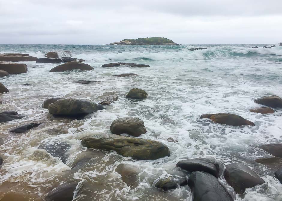
From the trail crossing it is about 1h walk to the rocky Buzios Beach (pictured). It is all covered with shells of different colours - throuly amazing sight and behind it stands the Turtle Rock. It separates the beach from the other ones. As you climb the rock you will have a nice view on the Buzios Beach below and other praias selvagems: Dangerous Beach, Beach of Hell, Half Beach and Back Beach.
It's not a small area so probably you need very long and intensive day to do the telegraph Rocks and all the beaches especially if you are coming from the Rio dentre. I recommend to split it on to two days.